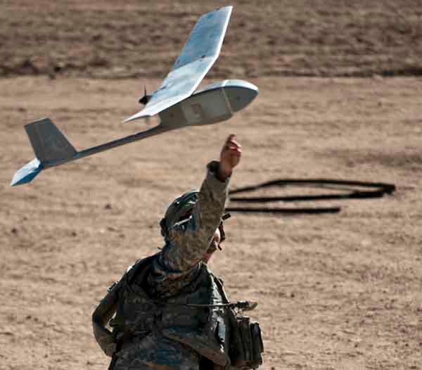
 In Search and Rescue organizations, unmanned aerial vehicles (UAVs or Drones) serve various support roles, including perimeter patrol, force protection, morale-boosting missions for ground elements, K9-training aids, public outreach demonstrations, and remote supply delivery. In Search and Rescue organizations, unmanned aerial vehicles (UAVs or Drones) serve various support roles, including perimeter patrol, force protection, morale-boosting missions for ground elements, K9-training aids, public outreach demonstrations, and remote supply delivery.
The primary use of UAVs during SAR operations is for Intelligence, Surveillance, Target Acquisition, and Reconnaissance (ISR), to serve the SAR mission of finding a target, fixing the target position, and finishing the rescue or recovery.
UAV SAR missions do not easily fit into a ready-made template. They are as diverse as the SAR exercises and organizations they support -- ranging from quick response in confined hazardous environments to persistent observation of large areas over long periods of time. UAVs come in many different models with varying abilities, weaknesses, and control methods, from autonomous swarms to satellite connected sensor networks, long-endurance high altitude planes to short-range quadcopters. Each mission profile has its own requirements for UAVs, technical support, and ground team integration. Additionally, UAV tasking is constrained by budget, organizational goals, and infrastructure.
UAV SAR use takes place in the following stages:
Acquisition - Budget, purchase, building and development of UAV and support infrastructure.
Planning - Integration of UAV assets into SAR mission, including assignment of roles, timelines, and mission plans.
Utilization - Moving the UAV into the operational area and connecting it with control and dissemination platforms.
Flight - Piloting and controlling the UAV in airspace.
Capture - Intake of raw data, video, or signals.
Storage - Retaining the data in an electronic medium.
Dissemination - Transmitting, copying, or moving the collected data to other (networked) systems.
Processing - Transforming the raw collected data into machine-readable, human-readable, or interoperable formats.
Analysis - Use of the formatted data by algorithms and/or humans for search, target acquisition, tracking, or display.
Production - Feedback of analysis into the system for useful purpose.
Exploitation - Using the produced directives or data to effect action in the real-world, either by the UAV or support teams.
“
In SAR, rapid deployment, constrained budgets, search team technical sophistication, and remote area infrastructures come into the forefront when considering UAV challenge factors
”
Many of these stages take place before SAR missions begin, outside the operational area, or away from immediate control of the SAR Incident Command. Nevertheless, it is vital to remember that the serving the SAR IC intent and goals remains the primary mission goal and purpose of the program. Therefore, integration of the UAV assets into a busy command workflow must be as distraction-free, painless, simple, and useful as possible. This planning must take place during the early phases of the Notional Operation Model (Shape, Deter) so that efforts during later phase activities (Seize Initiative, Dominate, Stabilize, Enable) can be most effective.
In SAR specifically, rapid deployment, constrained budgets, search team technical sophistication, and remote area infrastructures come into the forefront when considering UAV challenge factors:
Contested Operational Area -
Drone operations may take place in an area where drone operations are hindered by other aircraft, hostile forces, signal jamming, wildlife, harsh weather conditions, or environmental factors that limit deployment times or range. For example, grid flight patterns might be impossible to fly with a small quadcopter in a canyon or high-alpine environment, which might preclude processing the captured data with a grid-reliant mapping software type. Or GPS signals may be unavailable, making GPS-reliant processing algorithms useless.
Search Team Size and Ability -
The UAV should be a force multiplyer, and can improve utilization of less physically-able team members during earlier operation stages. Many SAR teams will operate with a Bring-Your-Own-Device (BYOD) tech model, or have leadership with practical field skills but lower expectations and tolerances for technological hurdles.
Commanders Intent -
The UAV must be subordinate to the will and orders of the Incident Commander, and avoid tail-wag-the-dog scenarios. Just as a SAR exercise that includes a scuba search should not assume an attitude of aquatic recovery, drone assets should not force a commander to shape his plan according to what the drone \"wants\". The UAV should be able to conduct multiple roles and switch roles as the commander's requirements change.
Time on Scene -
To maximize UAV potential during SAR, operators may choose to conserve batteries and reduce time in flight. Thus data capture and dissemination must be able to be flexibly targeted and rapidly deployed. The time from initial flight to exploitation by SAR command should usually be as short as possible, reducing time spent during Observe - Orient - Decide - Act
Scaleability / Elasticity -
From small SAR teams to large multi-agency data analysis, captured data must be scalable in dissemination and processing. If disseminated data is not available in a readable format for algorithms or humans, it cannot be analyzed or acted upon. Some SAR teams might need access to data month-by-month over long periods, or the ability to contrast location cues from season to season, or the ability to track a person in real-time during the event. Whatever the task, conditions in the field are likely to favor simplicity, clarity, integration, standardization, small file size, and high-latency networking.
Networking Constraints -
SAR operations are likely to take place in remote places or under conditions outside the technical ability of the team to maintain access to wireless networks, internet connections, or datalinks. Even when networking conditions are favorable, the need for rapid action and decision making will require fast access to selected data, rather than a \"firehose\" of raw data. Systems should have a variety of ways to capture, store, and disseminate data so that actionable intelligence can be produced quickly or \"on-the-ground.\" Stringent input requirements will tend to make useful data inaccessible or unavailable at key decision moments.
Parallel Workflows / Redundant Recovery-
To make the most of captured data, the data must be available for various teams to analyze in parallel. A human team waiting to deploy a search animal cannot wait for a university A.I. model to import data, georectify to mapping models, and run 10,000 regressions before they have access to a photo of the search area. A team of 10, each searching a grid zone on their own device, cannot do so if the only format for data is a 15-minute 4k video feed. Data must be retained and disseminated in a manner that allows rapid and parallel processing to happen.
Common Operating Picture -
In a confusing, unfamiliar, and complex environment, operators will make value judgements that narrow in degrees of confidence over time. Drone Intelligence that is too exacting or detailed, tied to specific conditions, or overlaid with too much undesired data can be disregarded or wrongly interpreted. Production and Exploitation of Drone data should be able to fit within a general planning model that allows some variation in interpretation. For example, getting exact distances or coordinate directions on the ground is far more difficult than measuring those distances and directions by air, so communicating \"30 degrees NNW 5632 meters\" may not be as helpful as \"Northwest of your position directly on the other side of that lake, by the inlet\" Go Teame!
|


